Looking at Puerto Vallarta Jalisco maybe five miles south.

On this blogger site one can click on all pictures except for the header above two times each time making them larger which is a feature I like because it gives you the ability to really look very close at all kinds of things not readily seen.

Wednesday, September 29, 2010

Lori Darlin

While hiking In Natural Bridges National Monument met Lori on the trail to Sipapu Bridge. It was a very pleasant surprise  and in a short time talked about a number of things. It was so much fun but she could not continue to the Horse Collar Ruins.

Just recently watched Lonesome Dove and Gus is a favorite character and because of the way he speaks to Lori why Lori Darlin these pictures are for you with a thank you for taking the time to chat and I hope you get to see these.

Most taken here were not very good and in fact the whole trip this past week the pictures and video we did leave a lot to be desired and below are a few of the better ones from this hike.

I know the ones I took with your camera were terrible and I didn't do much better with mine. Conditions in the canyon was just hard and did not figure that out until returning home late this afternoon.

There will be some type of short film but it will take a while to piece it together as again not too good of job. But there are a number of pictures that will be worth looking at for later.


This debris was 10-12 feet high on this tree. A deluge of  .18" of rain causes a gully washer in these areas.
You can click on these twice to make them bigger.
This ruin is called the Horse Collar Ruin for the obvious reason.

Somewhere in the neighborhood of 700-1000 years old and possibly more.
These were 75' give or take from the bottom of the wash.

And one from on top of the mesa above Valley of the Gods.

Monday, September 20, 2010

Lonesome Roads

Took a ride north of Craig,Colorado to the Wyoming state line then east and south to home. It was over 200 miles mostly on gravel or worse. Saw some good stuff as is generally the case. This is an interesting read. This was hard core Indian country around here and then the cowboys came.


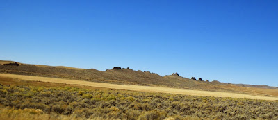
These are the rocks.


Don't forget about the pictures getting bigger if you click on them.

The high point on the left is Serviceberry Mountain and Bakers Peak and Little Emerson Peak can be seen through the trees.


The text below represent another post from Outta the Cornfield that was titled "Two Singles and a Triple" which will help you understand what you're reading. All the pictures were taken today but wanted to put more here at the picture place. 

Probably not what you're thinking but seriously this was a first on a cruise around the back country and briefly touching Wyoming today.

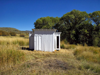
I came across this second but what we're talking about is the outhouse just to the left of this building.


You see these conveniences quite a bit and actually this one below is unique to me as well. On each side the is a single seater. Pretty dismal inside. What's different is the middle. Separate from the crappers themselves. I think that may have been where clothes were washed something like that.


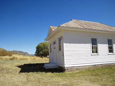
First had seen this in the distance and drove the two miles or so out to it and at one time there was a lot going on and probably cattle maybe sheep. The outhouse is the building on the right. The main living quarters was the building in the middle.


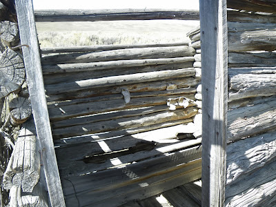
Looking through the front door of the house. Not a whole hell of a lot out here and a long way from anywhere.


Here she is the triple of the day and truthfully I've never seen one. See a lot of doubles but never this.  You better be friends with who you're sitting next to in one of these things that's for damn sure.

I don't have a picture at least one that I can find  of the two story crapper on what used to be the stage coach stop between Buena Vista and Aspen I believe. It's called Innisbrook with a two story hotel. Went out in an enclosed walkway. It's on the Colorado Trail which I worked on over a weekend a long time ago and need to go back and see this again. It's on the south side of Twin Lakes. If I remember correctly seating capacity with that baby was a dozen or so.


It was a beautiful fall day.

The rest of these pictures reflect fall colors and landscapes of Northwest Colorado. 


Sunday, September 12, 2010

Pictures From This Weekend - 09/11/10

The Utah ruins trip has been delayed until the weekend of the 25th. The nights will be a bit colder and the days  bit shorter as well but it will be fine and until then just gotta wait.

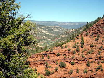
So stuck around here and these are a few things I took pictures of. Actually came away with a few pretty decent ones. I'm lucky I got the fish that I did but I climbed a lot more than I fished.

There happens to a coyote on the left of the first picture and even with the naked eye it looked like there was white on the end of the tail. Still think it was a Wiley. It's a bit odd as the white is visible.

Remember the clicking of the picture to make them big and then bigger.


I like both of these even though they are close to the same.


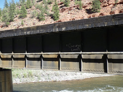
Did not do well on this one chance of the train on George Loves Bridge. Wasn't ready and needed to be standing where the picture was taken below.


This is the reason for the name we know it by.


When I came down from above I walked up this major watershed in between the red rocks. It's difficult to capture what this was like but as I gained in elevation it turned into a rock highway and that was pretty cool along with other erosion features.

As I walked and climbed up it was narrow in places with trees and the bank of course on both sides. If it wasn't rock it was hard red sand/dirt. Came upon some type of footprint of some sort that was not from a Bambi. Well what crossed my mind was mountain lion and there are bunches around this area - bunches. I'd been at this a long time and went down the drainage and even though I was really tired----


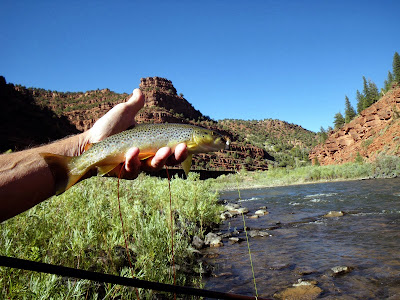
Caught this good looking feller.


These are from today and actually not that far from town. On some of these county roads not all are maintained completely so hardly anyone lives on those sections and they are easily passable unless wet or snow covered.

Don't people go for rides anymore. I saw a lot of cool stuff this afternoon and I was the only one anywhere.


I like this picture.


Cross posted @ One Fly's Picture Place

Saturday, September 11, 2010

Milk Creek Battle Site

I had heard of this site and took the time to drive to it last weekend. Someone has put a great deal of effort into this. The Ute's were one of the last tribes to be and I will use the word contained late in the 19th century. Shortly after this it was over for them as they were banished to a reservation in Utah.

For the back round on what happened here and you may find it very interesting you can read it about it right here.  And there is more to the story as on the same day at the Indian agency in what is now Meeker,Colorado agent Meeker was killed as well as his wife and others.

These are not the best pictures by any means but it's an attempt to put a face on this event and where it happened. The 5th picture is important.

Remember on Blogger you can click on pictures most of the time twice and they become much larger for great viewing. Move the cursor just a bit before the second click.


I will take the side of the Utes here and say it was Meeker himself who was the cause of this. The Utes were for the most part more social and forgiving than other Native Americans.


Apology's for the bad picture here.

It's unclear what the plans are here but there is drip irrigation and trees planted all around the perimeter and as  you can see fairly large pieces of stone to be used later for something. I have a feeling it will be something for the soldiers as that's the way it usually works.

Driving on the back roads out here in NW Colorado it is very obvious it is the white guys these days who have become hostile!
Related Posts Plugin for WordPress, Blogger...